Mount Polley tailings pond breach – Where do we go from here?
On August 4th 2014, the tailings pond at Mount Polley mine breached. A newly estimated total of 10.6 million cubic meters of water, 7.3 million cubic meters of tailings solids, 6.5 million cubic meters of interstitial water (water contained within the rock and sediment) and 0.6 million cubic meters of construction materials were released into the environment.
A local state of emergency declared on August 6th still remains in place for the region (including Likely), although that is expected to be removed shortly once the tailings pond breach is closed.
On August 6th I provided a brief assessment of the conditions leading up to the Mount Polley disaster. At the end of the article I promised to seek answers to a number of questions that I had posed. The questions are reproduced here:
1) What support is government offering to local communities including local First Nations to help fund this period of transition?
2) Will there be any impacts on the Fraser River salmon run?
3) What is the best practice in cleaning up a tailings pond spill, especially given the limited number of incidences in BC that this has happened (at this time Minister Bennett is saying this has never happened before in the province)?
4) What contingency plans exist in government to help support its efforts financially to address this disaster, including if Imperial Metals declares we’re unable to pay for the cleanup?
5) What role has the government’s cuts to enforcement and their approach to enforcement played in causing this accident?
6) Are there other tailings ponds that should be red flagged?
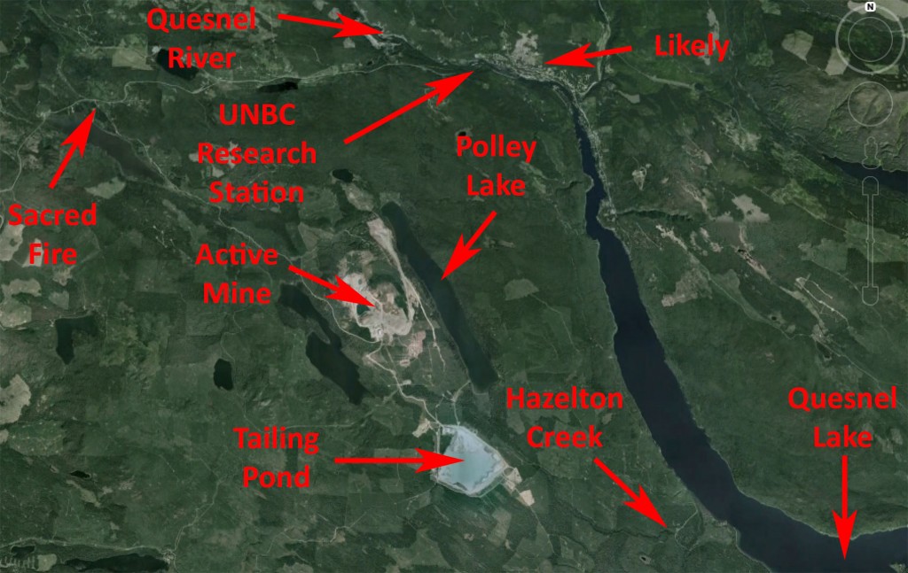
I was fortunate to be able to visit the Mount Polley mine site including the base of the tailing pond breach on August 28th (see Figure 1). There I was able to witness the local environmental degradation first hand. Upon completion my tour of the mine site, I stopped in at the Secwepemc Sacred Fire and the Yuct Ne Senxiymetkwe Camp for an hour to listen to the concerns of those present. I had the enormous honour of being granted tobacco by a Secwepemc elder to throw on the scared fire.
Next on the agenda was as stop at the University of Northern British Columbia (UNBC) Dr. Max Blouw Quesnel River Research Centre. There I discussed ongoing research and monitoring initiatives being conducted by scientists working at the facility. After a quick trip to see the town of Likely, it was back to Williams Lake airport to return home to Victoria.
Figure 1: Map of the Mount Polley region showing the location of the various stops on my visit to the region.
In what follows, I detail what I have learned from my visit concerning the Mount Polley tailings pond disaster, offer a number of recommendations for, and provide a list of questions that I believe need to be addressed by, those involved in responding to this environmental, social and economic disaster.
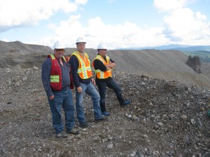 I want to offer my sincere thanks to the Secwepemc for allowing me to visit the sacred fire and burn a tobacco offering. I am also extremely grateful to mill superintendent and mining engineer Doug Ablett, as well as Steve Robertson, Vice President Corporate Affairs for Imperial Metals (see photo to right), for spending more than two hours with me as we toured the mine, the mill and the vicinity of the tailings pond. Finally, I am grateful to local resident Jenny Howell, and Sam Albers from the UNBC Research Station for spending time with me at the Quesnel River Research Centre.
The Breach
In the early morning hours of August 4 the Mount Polley Tailings pond breached. Area residents woke up to the sound of water as the once two metre wide Hazeltine Creek became a raging fifty metre river of slurry (see video below). A aerial helicopter video survey taken later in the day clearly shows the scale of the environmental destruction. Polley Lake was plugged by tailings and debris, causing lake levels to rise by 1.7 metres. Hazletine Creek was destroyed and the tailings pond substantively drained into pristine Quesnel Lake, British Columbia’s deepest Lake. At its northern edge, Quesnel Lake drains into Quesnel River, a major tributary of the Fraser River.
Video 1: RCMP video of Hazeltine Creek the day after the breach (left); Caribou regional district aerial video of the area after the breach had occurred.
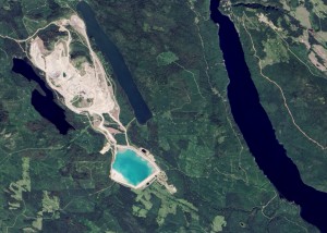
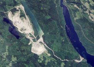
NASA satellite images taken before and after the breach (Figure 2) clearly indicate the route of the tailings. The widespread presence of suspended sediments in the now turbid Polley Lake is evident. A plume of suspended sediments is also seen emanating from the mouth of Hazeltine Creek where it enters Quesnel Lake (Figure 2).
Figure 2: NASA Landsat 8 satellite imagery taken before (left) and after (right) the Mount Polley mine tailings pond failure. The left image was taken on July 29, 2014 and the right image was taken on August 5, 2014, a day after the breach. Images taken from NASA image database where a sliding overlay is also available for direct before/after comparison.
The Initial Response
On August 7th the B.C. Green Party and I called on the provincial government to require every mine in the province to undertake an independent engineering report of their tailings storage facilities. On August 15th, the BC Green Party went further by putting together a petition that called on the B.C government to:
Immediately establish a fully independent process to investigate the Mount Polley mine disaster; and require every mine in the province to undertake an immediate, fully independent engineering report of their tailings storage facilities.
The petition quickly garnered over 2000 signatures and became moot when on August 18th, the provincial government announced that it would do precisely what we had called for. We were quick to support the announcement of these independent reviews.
The independent review panel that will investigate the causes of the Mount Polley breach is made up of three distinguished engineers. The panel chair Dr. Norbert Morgenstern, is an Emeritus University Professor in the Department of Civil and Environmental Engineering at the University of Alberta. The other committee members are Dr. Dirk Van Zyl, a Professor at the University of British Columbia, Norman B. Keevil Institute of Mining Engineering, and Steven Vick, a consulting engineer from Colorado who has literally written the book on the planning, design and analysis of tailings dams. I am of the firm opinion that British Columbians should have every degree of confidence that this blue-ribbon panel will come to the bottom of what caused the breach to occur. But this panel will not deal with questions concerning the clean up and long term environmental monitoring response.
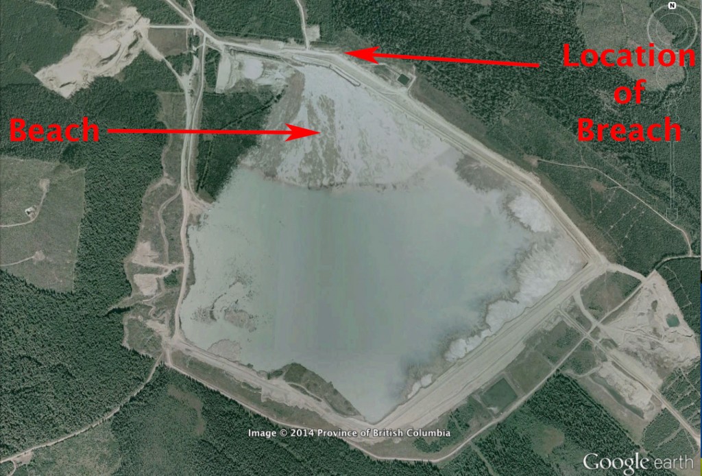
One question that I have for this panel concerns the extent to which water levels in the tailings pond were too high. Tailings are typically released into ponds along the boundary of the pond. The water runs away from the dam leaving a beach of tailings behind. Such beaches provide extra buttressing for the earthen dams. Figure 3 is a high resolution image taken from Google Earth. A beach is clearly evident at the site where the breach occurred on August 4th. Looking at Figure 2, taken a few days before the breach, no beach is present there and the water level appears to be high.
Figure 3: High resolution Google Earth image of the Mount Polley tailings pond showing a tailings beach and the location of the eventual breach.
The British Columbia Ministry of Environment has done an admirable job regularly reporting water, fish, sediment and other analyses in their Mount Polley incident updates. In addition, Imperial Metals is holding regular meetings with local residents to provide updates and answer their questions. Residents shared their concerns with me during my visit regarding long term monitoring of air, water and aquatic life in the region.
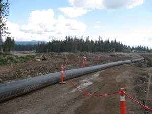
With debris blocking the outflow from Polley Lake to Hazeltine Creek a potentially urgent situation arose. Water levels began to rise in Polley Lake and Imperial Metals was concerned that another breach would occur at the plug. As such they installed a pipeline that allowed Polley Lake to drain downstream into the now widened Hazeltine Creek. One is left with the question as to why Polley Lake was not directly drained in to Quesnel Lake instead of via Hazeltine Creek?
The company has been working to fill in the breach. On my visit, I witnessed a flurry of activity and a steady stream of massive haul trucks bringing rock and boulders to a growing dyke designed to fill gap where there was once an earthen dam. Nevertheless, on September 9, the Ministry of Environment wrote to Mount Polley Mining Corporation finding them “to be out of compliance with the Environmental Management Act (EMA) because effluent was still discharging from the tailings storage facility into Hazeltine Creek.”
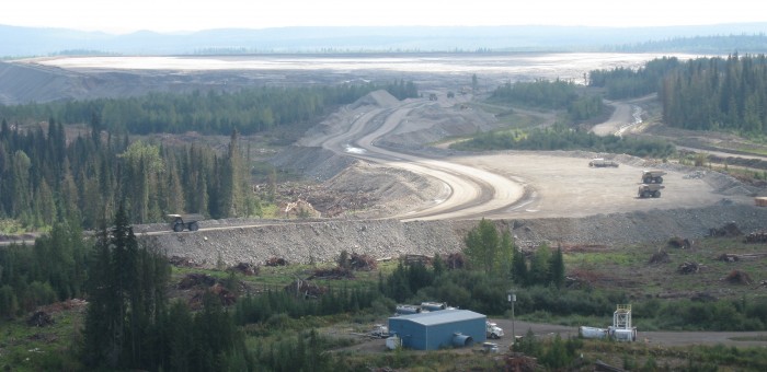
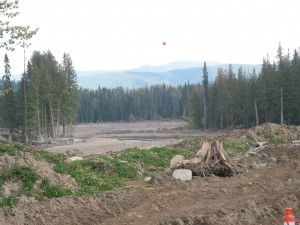
Figure 4: Photographs taken at the base of the tailings pond breach showing (left) a pipeline transporting water from Polley Lake to Hazeltine Creek and (right) what remains of a forest that was destroyed immediately in front of the breach.
The left panel of Figure 4 clearly shows open space where once there used to be forest. The trees that were uprooted during the breach ended up along the side and at the mouth of the now much wider pathway for Hazeltine Creek, as well as in Mitchell Bay just south of where Hazeltine Creek joins Quesnel Lake. The company is presently harvesting those trees and sorting them for sawmills, pulp and hog fuel. Another question I have is where the revenue arising from the harvesting of these trees is being directed?
Mount Polley Mine and Tailings Ponds
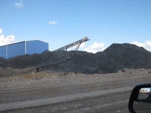
The Mount Polley mineral deposit was first discovered in 1964 but it wasn’t until 1997, that Imperial Metals opened it’s mill and mine. The Copper/Gold/Silver mine was initially quite small, processing only about 18,000 tons of ore per day. By 2001, the mill shut down production but was reopened again in 2005, after the discovery of new high grade ore deposits on the property. Since that time, aggressive exploration and expansion grew the mine to a point where it was processing 22,000 tons of ore per day and expected to produce 44,000,000 pounds of copper, 47,000 ounces of gold and 120,000 ounces oz silver in 2014. Magnetite is also produced at Mount Polley in partnership with Craigmont Industries (Figure 5).
Mount Polley’s alkalic porphyry (igneous [originating from magma] rock containing crystals) large, low-grade and heterogeneous copper-gold deposit is mined from two open pits (Figure 5) and one underground mine. The mine site was expected to be open until 2025 and prior to the breach, it was a closed system with all water remaining on site. Imperial Metals undertakes progressive reclamation of its waste rock and mine sites including applying Metro Vancouver biosolids on the disturbed areas. As noted in their 2013 Annual Information Form:
“Reclamation work in 2013 included: re-contouring of a total of 4.94 hectares; till/soil placement on 7.84 hectares; grass seeding on 1.81 hectares; and tree/shrub planting on 3.30 hectares. On the North Bell dump, 2.34 hectares also received an application of biosolids provided by Greater Vancouver Regional District. The total area reclaimed (including trees and shrubs) to date on site is 25.41 hectares. Site preparation consisted of re-sloping and contouring of the area, which was followed by soil application, landform design and hand seeding and planting”
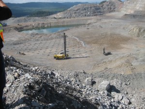
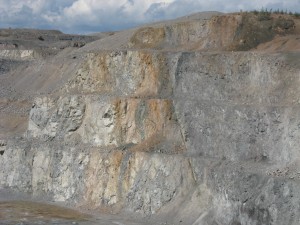
Figure 5: (top left) Photograph oft Mount Polley’s Caribou pit (in the foreground) and Springer pit (in the background). (top right) Close up of Caribou fault along the wall of Caribou pit. (bottom) Magnetite piles.
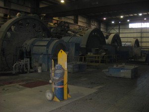 Non-leaching, non-acid generating rock is mined at Mount Polley. This is ground in three stages and washed through a gravity circuit and then fed through a froth floatation circuit. At this stage the ore-bearing minerals are skimmed off and what is left are tailings (sand- and silt- like solids) and waste water, combined with very small quantities of residual chemicals (Potassium amyl xanthate, W22C, and Sodium Hydrosulphide) used in the frothing process. The tailings are relatively benign upon release.
Leaving tailings exposed on the land can be problematic as oxidation and runoff (after rain) can create highly problematic acidic conditions in the neighbouring environment. Tailing ponds are designed to keep the tailings under water to prevent exposure to the atmosphere (and hence oxidation). Oxidation of sulphides present in the tailings can produce sulphuric acid. Typically, lime is added to the tailings in order to neutralize the acidity.
The water in Mount Polley’s tailing pond, fortunately, was basic and not acidic prior to the breach (a pH of about 8.5). As such, the release would not have put substantive quantities of acid into Quesnel Lake. Compare this to the Aznalcóllar Tailing Pond Disaster that occurred on April 25th, 1998 at the Boliden Apirsa mine in southern Spain. About 5.5 million cubic metres of highly acidic water (with a pH of between 2 and 4) and 1.5 cubic metres of tailings escaped through the breach and into the Agrio River and its watershed.
Sacred Fire
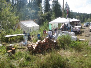
Secwepemc Sacred Fire was lit on August 18th and the Yuct Ne Senxiymetkwe Camp set up shortly thereafter. I had the honour of chatting with people at the campsite. While there, a number of area residents also stopped by to support those holding vigil.
I wanted to hear from everyone present as to what they believe should be done, both in the short and long term, in response to the tailings pond breach. I found the requests to be well thought out and entirely reasonable.
Here is what I was told, in no particular order. Obviously these are not all inclusive and they are only based on the views of the people I spoke with:
- The immediate establishment of an expert monitoring team that includes triggers for action if monitoring reveals a potential health or environmental problem;
- Consultation with local First Nations and residents about what should be monitored. The expert team needs local knowledge to inform them about what is important to people in the region;
- A bottom-up crisis response team which will assist people with questions, concerns, and dealing with the disaster;
- Effective communication from Imperial Metals and the BC Government;
- “Do what you say”. Building trust is crucial in moving forwards. If Imperial Metals or the BC Government say they will do something, locals want confidence that it will be done;
- Keep the water out of Quesnel Lake. The people were concerned that Polley Lake overflow was being piped into Hazeltine Creek instead of directly to Quesnel Lake;
- Set up an independent panel of experts, locals and First Nation representatives to determine the best path forward with respect to response and remediation .
UNBC Dr. Max Blouw Quesnel River Research Centre
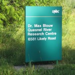 The University of Northern British Columbia has a research station located along the banks of the Quesnel river just after it leaves Quesnel Lake. In response to the Mount Polley disaster, they initiated a water, sediment and biological sample collection program and will report back with their initial results at their open house on October 4.
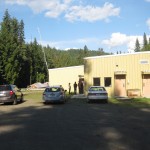 It’s clear to me that researchers at the centre have very real concerns that contaminated, sediment-laden water will enter the Quesnel River system periodically. Given that this is a salmon bearing river and a major tributary for the Fraser River, I believe it is important that their monitoring efforts be supported and studied carefully.
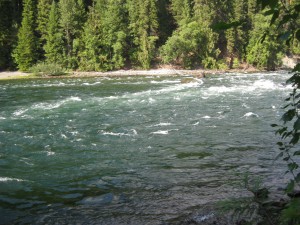 There have been reports of a turbidity plume in Quesnel Lake 35-50 metres below the surface. In addition, a recent study by Laval et al. (2008) observed the occurrence of upwelling events at the outflow of Quesnel Lake to Quesnel River. Such occurrences happen in the summertime when the lake is stratified and are thought to be caused by episodic wind events. Were such upwelling events to occur, as has been observed in the past, the turbid subsurface Quesnel Lake waters could be brought to the surface and exported into the Quesnel River. In my discussions with the UNBC researchers, they described recently observing precisely such an event shortly before my visit. Over the course of just 15 seconds, waters entering Quesnel River dropped by 5°C and their turbidity rose dramatically. The source of this cold, turbid pulse had to come from subsurface waters in Quesnel Lake.
So where do we go from here?
Political Cost
There have been a number of newspaper stories pointing out that Imperial Metals, its controlling shareholder and Mount Polley were all major donors to the BC Liberal Party (see for example a Vancouver Observer article). Imperial Metals was a very minor donor to the BC NDP as well. But the BC NDP also received substantial donations from the United Steelworkers Union, the union that represents workers at the Mout Polley mine. In fact, Stephen Hunt, USW District 3 (Western Canada) Director, specifically called for USW members to support the BC NDP in the May 2013 election.
Federally, unions, corporations and foreigners are not allowed to make contributions to election campaigns or political parties. Individuals are only allowed to donate up to $1,200 annually. This is not the case in British Columbia. Any business, union or individual anywhere in the world can contribute any amount to any political party any time they wish.
Of course, foreigners, corporations and unions don’t vote. People do. That is why I continue to advocate for provincial electoral financing reform that would ban corporate and union donations and limit the allowable contributions from individuals.
Governmental Cost
In 2001 after the BC Liberals were elected to their first term, they began a comprehensive core review to cut the size of government. Premier Campbell asked all government departments to prepare scenarios as to what it would look like with 20%, 35% and 50% cuts to spending. At the time, revenue to the province from the oil and gas sector was substantive. As such, when the Ministry of Energy and Mines had to implement their cuts, they targetted them almost exclusively in the mining sector. One former senior administrator I talked with said that the in the end, the Ministry was asked to cut its budget by 30%. But that meant little, if any, cuts to energy and nearly 70% cuts to mines.
As a member of the School of Earth and Ocean Sciences at the University of Victoria, I have a very vivid memory of the decimation that occurred within the BC Geological Survey at the time. The mining enforcement and compliance budget was also severely cut back. For example, a recent story in the Vancouver Sun pointed out that the Mount Polley tailings pond only required a “critical dam safety review every 10 years by an independent engineer.” Concern also exists as to the ability of Imperial Metals to pay for the cleanup and the extent to which the public is left to pick up the tab for any remediation measures.
After meeting with a number of former Ministry executives, I arranged for a meeting with the BC Auditor General. I asked them to see if, in light of the Mount Polley accident, they would be willing to investigate the effects of the early cuts over the last decade to mining regulatory compliance and enforcement initiatives. I look forward to hear whether or not this will occur in the weeks and months ahead.
It seems clear to me, however, that independent of any review by the Auditor General, government needs to take a hard look at the extent to which it ensures that resource-extraction companies have sufficient indemnities, or have put aside large enough bonds, to ensure that taxpayers are not on the hook for any potential industry-based disaster. At the same time, enforcement and compliance measures need to be stepped up and adequately funded in the various ministries responsible for public oversight of resource projects in the province.
Social Cost
Let us not forget the social cost of the Mount Polley tailing pond disaster. There are 370 local residents employed at Mount Polley mine. While many of these residents are still working as the company scrambles to deal with the breach, the mill is not operating. More and more layoffs will happen in the near future. And then there are the social costs that are less easy to quantify. These include the potential real or perceived effects that the spill will have on the local eco-tourism industry.
As noted by those who I talked to at the Sacred Fire, the establishment of a bottom-up crisis response team that will assist people with questions, concerns, and dealing with the disaster might help those immediately affected.
Environmental Cost
The numerous pictures above paint a clear picture of the immediate environmental damage caused by the breach. Hazeltine Creek has been destroyed, as has the south end of Polley Lake. Tailings have entered Quesnel Lake and Polley Lake. While recognizing what has happened, two questions emerge:
- What will be the long term consequences to the region?
- What should be done in terms of remediation?
To answer the first, we need to recognize that one of the primary concerns of residents in the region is the potential effects that the tailings will have on salmon spawning grounds. Another concern relates to whether or not the water in Quesnel Lake will become contaminated.
With respect to the first concern, respected UBC Fisheries Scientist Carl Walters noted that “I still don’t think it will be a serious problem, but I just can’t say for sure“. With respect to the latter, it is almost certain that once the tailings sediments settle out to the bottom of the very deep Quesnel Lake, they will be stable. Furthermore, naturally-occurring sedimentation would eventually bury them. For example, Pedersen (1983) examined the tailings that were placed at the bottom of Buttle Lake in Strathcona Park and found them to be very stable.
Moving forward, I fully support the suggestion of setting up an independent panel of experts, locals and First Nation representatives to determine the best path forward with respect to response and remediation. It may turn out that remediation could be as simple as covering the tailings at Hazeltine Creek with soil and replanting trees; it may turn out to be much, much more. But that should be determined by an arms length panel of scientific experts, locals and First Nations.
As a summary, it looks like the British Columbia may have dodged a bullet. While not making light of the disaster, it could have been a lot worse. Non-leaching, non-acid generating rock were mined at Mount Polley; the water in the tailings pond was not acidic; Quesnel Lake is very deep. Were such a breach to have occurred at another mine, we may not have been so fortunate.
Economic cost
An editorial in the Northern Miner, a highly regarded source for mining news, described the Mount Polley tailing pond breach as the “the most depressing thing to have happened in Canadian mining since the Bre-X Minerals debacle in 1997“. In my view, the economic ramification of this disaster is likely to be the longest lasting and potentially most damaging result arising from Mount Polley breach. As noted above, British Columbia potentially dodged a bullet from an environmental perspective. But if such an accident can occur at the operations of a well-established and highly regarded mining company, imagine what other potential accidents are lurking out there.
I am pleased that the British Columbia government has “issued an order to all mining companies to conduct a Dam Safety Inspection for every tailings storage facility at a permitted mine by Dec. 1, 2014.” But let us not forget, it is critical that the ministry responsible for mining be funded adequately to ensure that they have sufficient staff and resources for their regulatory compliance and enforcement measures.
After all, we all know that an ounce of prevention is worth a pound of cure.
References:
Laval, B.E., J. Morrison, D.J. Potts, E.C. Carmack, S. Vagle, C. James, F.A. McLaughlin and M Foreman, 2008:Wind-driven summertime upwelling in a fjord-type lake and its impact on downstream river conditions: Quesnel Lake and River, British Columbia, Canada, Journal of Great Lakes Research, 34 (1), 89–203.
Pedersen, T.F., 1983: Dissolved heavy metals in a lacustrine mine tailings deposit—Buttle lake, British Columbia. Marine Pollution Bulletin, 14(7), 249–254.



5 Comments
‘MPMC ordered 900 25kg bags of fast germinating grasses, which have been applied to exposed areas in an effort to provide vegetative cover.’ But no mention made of the toxic waste being covered with NON-CONTAMINATED SOIL FIRST, as they indicate they did in reclamation work in their 2013 Annual Information Form. Who is going to keep the DEER, ETC away from the grass come spring? After farmers spread ‘coal stone’ high in SELENIUM on their land, ‘ 19 of 23 local inhabitants showed visible Se poisoning symptoms and ALL LIVESTOCK IN THE VILLAGE DIED IN 1963’ http://www.springer.com/…/cda…/9789400714380-c2.pdf… ‘The Se-enriched coal stone was utilized as fuel materials for cooking and making lime by the villagers in Enshi, and they were also ground into powder as an agricultural fertilizer (Zhu et al. 2008b). Moreover, villagers in Enshi also discharged lime onto cropland to improve the soil quality during land clearing for agriculture or cultivation (Yang et al. 1983). These anthropogenic activities accelerated the release and transport of Se from coal stone into the food chain and very likely caused the Se poisoning in Enshi (Zhu et al. 2008b)’.
In this post you discuss the sediment in the lake proper but everyone seems to ignore the elephant in the room which is the huge amount of material along Hazeltine Creek. No analyses of the material have been presented. Based on the sediment data (since the sediment and surface material comes from the same source) the “soil” on the surface would likely be considered contaminated under the Contaminated Sites Regulation of the Environmental Management Act based on its copper concentrations. As any Biologist will tell you cooper is a toxin to the invertebrates that form the base of the food-chain in that lake. No data has been presented to confirm whether rainfall run-off from the material will represent an ongoing source of copper-rich water into Hazeltine Creek.
In any other part of the Province a release of this much “contaminated” material would require a detailed plan for clean-up and not a cursory side-note about restoring Hazeltine Creek. Is anyone going to ask these questions.
Hi Blair, I agree. A number commented on why Polley Lake waters were being pumped into what is left of hazeltine creek. A question I would like an expert team on the ground to deal with is whether it is better to leave tailings in place and bury them or try and get rid of them. The scale of the latter would be rather large. Cu monitoring is crucial too.