Local Government
Soils in the Shawnigan Lake Watershed — More Questions
 Back in April I wrote a piece on the wisdom of dumping contaminated soils in the Shawnigan Lake watershed. I visited the region with Shawnigan Lake Area Director Sonia Furstenau. Together with a few other Shawnigan Lake residents, we hiked around on parkland owned by the Cowichan Valley Regional District. I took this opportunity to take a number of photographs. More importantly, I took the opportunity to collect water samples.
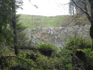 The results of these water samples, together with my observation that a significant amount of fill had over run Lot 21 and was on the neighbouring parkland, led me to subsequently ask the Minister of Energy and Mines and the Minister of Environment questions in Question Period.
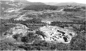
As background, Lot 21 is the property located at 638 Stebbings Road and is owned by 0782484 B.C. Ltd. For several years, soil has been dumped Lot 21 for later use to backfill the quarry in lot 23. A photograph of the northern boundary wall of deposited soils is shown to the left. This photograph was taken from CVRD Parkland on the north side of Shawnigan Creek.
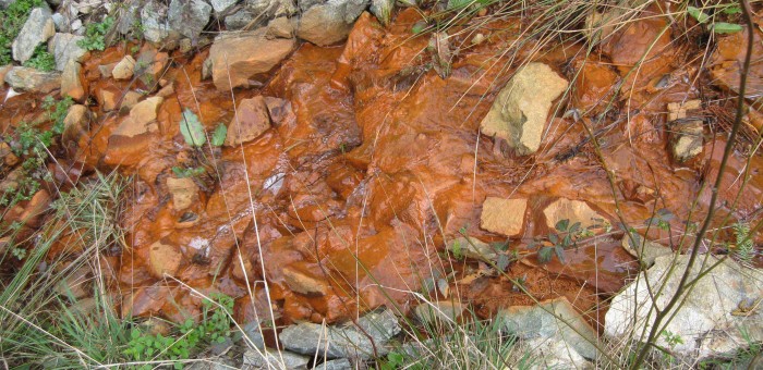
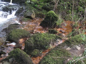
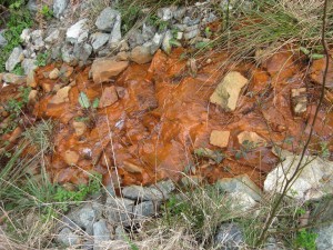 I outlined in my earlier post that it was apparent to me that substantial amounts of building materials had been placed on Lot 21. There was also clear evidence that runoff from this site failed drinking water standards at the point of entry with Shawnigan Creek. And visually, this water looked nothing like any other water in nearby surface and running water (see image to the right).
On May 15th I went back to the area to get a better sense as to what metals were contained in the orange sediments under the orange water. Since the water runoff came from Lot 21, my goal was to determine if sediments in this stream were any different from sediments at a control location upstream of Lot 21.
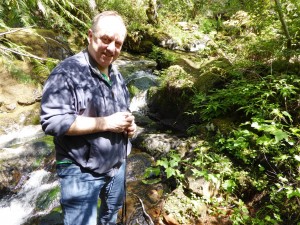
Four different sediment samples were obtained. Two of the samples were collected upstream of Lot 21 in order to obtain a control sample. The first, termed FLOW, in the attached data, was taken in the middle of Shawnigan Creek (see Figure 1 below). FLOW data will be used as the control sample below. The second sample (BANK in the attached data) was located at the bank of Shawnigan Creek immediately adjacent to where FLOW was collected.
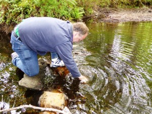
Figure 1: Photographs showing me collecting the control sediment sample in the middle of Shawnigan Creek, upstream from Lot 21.
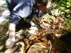
The third and fourth samples were collected where the orange runoff entered Shawnigan Creek (Figure 2), The third, termed CREEK, in the attached data, was taken in Shawnigan Creek right at the location where the runoff enters the creek. The fourth sample was obtained about a metre upstream of the runoff stream. This is termed POOL in the attached data.
Figure 2: Photographs showing me collecting the sediment samples at the location where the Lot 21 runoff meets Shawnigan Creek (left) and in a pool a metre or so upstream of the creek in the covenant along Shawnigan Creek (right).
As in my earlier post, the metal contents in the sediments were determined using an inductively coupled plasma mass spectrometry (ICPMS). The method for the bulk analysis of acid extractable elements (that is trace elements not bound in silicate minerals) was as follows:
1) The vial was shaken to homogenize and all for the removal of an aliquot for analysis (2 mL aliquot for BANK and POOL, 10 mL aliquot for CREEK and FLOW).
2) 10 mL of 8 Molar Environmental Grade Nitric Acid was added and allowed to react overnight.
3) The sample was diluted to 50 mL with 18 mega ohm deionized water.
4) The mixture was shaken to homgenize
5) The sample was put in a centrifuge for fifteen 5 minutes at 3000 rpm to separate out any residual particulate.
All concentrations in the attached data are given in (μg/L). Since there were different amounts of sediments in the individual samples, it is not possible to directly compare their element concentrations. Rather, I will focus on what is called the enrichment factor for each element after normalization with the commonly occurring element Calcium (Ca).
By definition then, the enrichment factor of a mineral XX is:
Enrichment Factor = (XX[sample]/Ca[sample])/(XX[control]/Ca[control])
Here [sample] refers to the concentration in a collected sample (in μg/L) and [control] means the concentration in the control sample (also in μg/L).
The attached data clearly show the presence of an enriched industrial metal content of the POOL Sample.
The following elements were found to be enriched by:
Between three and four times the control values:
Magnesium (Mg), Vanadium (V), Chromium (Cr), Manganese (Mn), Cobalt (Co), Molybdenum(Mo), Caesium (Cs), Barium (Ba), Hafnium (Hf).
Between four and five times the control values:
Lithium (Li), Scandium (Sc), Germanium (Ge), Zirconium (Zr), Tin (Sn).
Between five and ten times the control values:
Niobium (Nb) [enriched 5.29 times higher than control]; Lead (Pb) [enriched 5.19 times higher than control].
Greater that ten times the control values:
Iron (Fe) [enriched 11.69 times higher than control]; Thorium (Th) [enriched 18.60 times higher than control].
After examining the elemental sediment analysis, I am left with a number of serious concerns. The enriched metal values in the sediments under the runoff leaving Lot 21 suggest that their source comes from somewhere upstream and likely within Lot 21 itself. The question I am left with is this:
What, if anything, has been buried on Lot 21 that could produce the Thorium, Lead and other heavy metal enrichment in the sediments?
On the Wisdom of Dumping Contaminated soils in the Shawnigan Lake Watershed
Background
On August 21, 2013 the Ministry of Environment (MOE) granted South Island Aggregates Ltd. (SIA)/ Cobble Hill Holdings (CHH) a 50-year permit to receive up to 100,000 tons of contaminated soil annually (a total of five million tons). The proposed location of the site for the contaminated soils is the SIA quarry located at 640 Stebbings Road (Lot 23 owned by CHH). This is located off South Shawnigan Lake Road between Shawnigan Lake and Highway 1. SIA proposed to back fill their quarry with contaminated soils while they continued to blast for new aggregate material. The permit was granted subject to “requiring complete containment of the soils to be introduced into the quarry.”
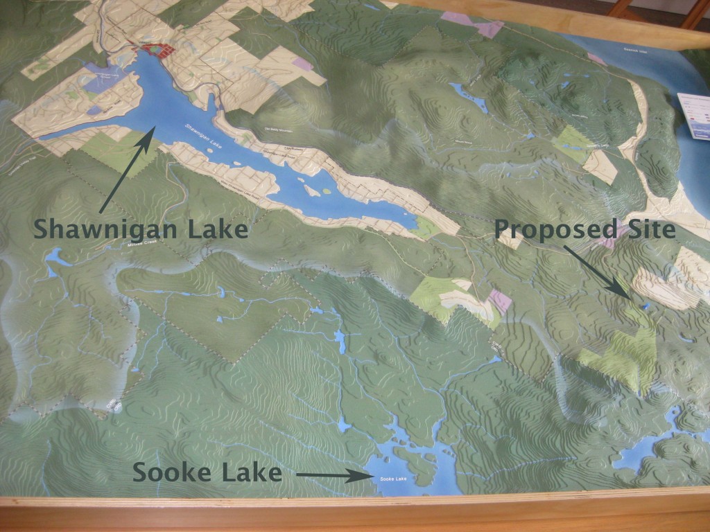 Figure 1: Photograph of a topographic map showing the locations of Shawnigan Lake, Sooke Lake and the proposed site for the contaminated soils.
Five days later, the Shawnigan Residents Association (SRA) appealed the Ministry’s decision to issue SIA a permit. They cited five reasons for their appeal. The first three were:
1) The testing and assessment of the suitability of the site’s geology and hydrogeology was inadequate and incomplete.
2) The monitoring and water treatment plans were deficient.
3) The MOE failed to apply the appropriate test for the issuance of the Permit in that it failed to:
(a) ascertain the degree of scientific uncertainty about the hydrogeology, water monitoring and treatment technologies and plans;
(b) in view of the uncertainties, identify the degree of risk that the facility will not succeed in permanently containing the contaminants and toxins in the five million tons of contaminated soil to be deposited at the site.
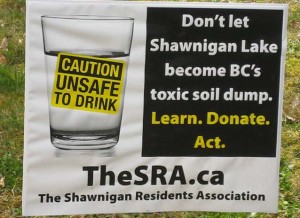 Initially, I was reluctant to wade into this issue. But as time rolled on I started to receive a number of emails and letters from concerned constituents who had vacation properties on Shawnigan Lake.
The proposed location of the contaminated soil site (Figure 1) is at an elevation above both Shawnigan Lake, the water source for about 5,000 local residents who draw directly from the lake, as well as Sooke Lake, the reservoir for Greater Victoria’s water. An additional 7,000 or so residents get their potable water from within the Shawnigan Lake watershed. Surface water runs into Shawnigan Lake while the path taken by groundwater is plagued with great uncertainty.
In its application for a stay pending a decision from the Environmental Appeal Board, Shawnigan Residents Association noted expert testimony from hydrogeologist Dennis Lowen that argued: “The site is not suitable for a landfill”. They further submitted:
“The ground on which the landfill is to be located is fractured bedrock… The site itself is an active rock quarry… The quarry has only been 4% mined, so blasting and excavating is ongoing… backfilling will be accomplished using contaminated soil instead of clean fill …the site would not, for example, be acceptable for a secure landfill under Hazardous Waste Legislation.”
On September 13, 2013, the Cowichan Valley Regional District also filed an appeal to the Environmental Appeal Board. They too took a very strong position against the proposed contaminated soils site. Amongst a variety of other concerns, they argued that:
a. There is a divergence of professional opinion and significant uncertainty in the geology and hydrogeology of the area and the associated risks to drinking water resources.
b. The characterization of the geology and hydrogeology of the area is based on a limited amount of data and a limited number of wells and boreholes not evenly distributed around the property and surrounding area.
c. The design of the proposed contaminant soil treatment facility and landfill facility does not adequately ensure that contaminated soil and ash or the associated effluent will not adversely impact drinking water resources or the environment.
Professional Reliance
In 2001 after the BC Liberals were elected to their first term, they began a comprehensive core review to cut the size of government. Premier Campbell asked all government departments to prepare scenarios as to what it would look like with 20%, 35% and 50% cuts to spending. As a direct consequence of government downsizing, technical expertise within the civil service became a casualty. Instead of having technical expertise in house, the government moved towards wide scale use of Professional Reliance in the permitting process. Under the Professional Reliance approach, the Ministry relies on the judgment and expertise of qualified experts hired by a project proponent.
What is particularly important to note is that in March 2014, the Office of the British Columbia Ombudsperson released a scathing report criticizing the Professional Reliance model with respect to streamside protection and enhancement areas. The report, entitled The Challenges of Using a Professional Reliance in Environmental Protection – British Columbia’s Riparian Areas Regulation made 25 recommendations, 24 of which the government agreed to accept. But this acceptance came almost a year after the Ministry of Environment granted SIA their permit.
My own personal view is that the government’s approach to follow the Professional Reliance model is fraught with difficulties. The role of the government is to protect the public interest. When government is making decisions solely based on a project proponent’s expert opinion, it is very troubling. Imagine a judge in a court of law only listening to the expert opinion on one side of a case (plaintiff or defendant) and not allowing expert opinion to be submitted from the opposing side.
As such, the concerns of both the CVRD and the SRA seem particularly relevant in light of the fact that they themselves brought in expert testimony that contradicted the project proponent’s evidence.
638 Stebbings Road
 The property located at 638 Stebbings Road (known as Lot 21) is owned by 0782484 B.C. Ltd. and has been in use for quite some time as a fill site. A photograph of the northern boundary wall of deposited soils is shown to the right. This photograph was taken from CVRD Parkland on the north side of Shawnigan Creek. Lot 21 is located immediately adjacent to Lot 23. In November 8, 2013 the Environmental Appeal Board granted a stay in proceeding to the SRA and CVRD until such time as their full appeal was heard. In their decision, the Environmental Appeal Board noted a number of serious concerns regarding Lot 21. For several years, soil has been dumped Lot 21 for later use to backfill the quarry in lot 23.
My site visit to the region
On the afternoon of Thursday April 2, 2015, I visited the region with Shawnigan Lake Area Director Sonia Furstenau. Together with a few other Shawnigan Lake residents, we hiked around Lots 21 and 23 on parkland owned by the CVRD. I took this opportunity to take a number of photographs. More importantly, I took the opportunity to collect water samples.
 Figure 2: Google Earth image showing the location of the SIA rock quarry and the sites where water samples were collected.
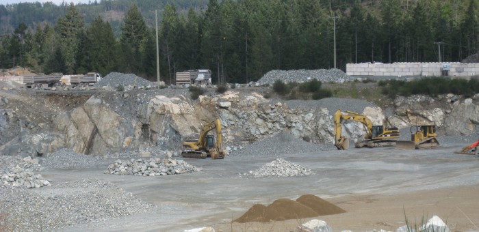
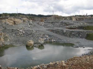
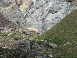
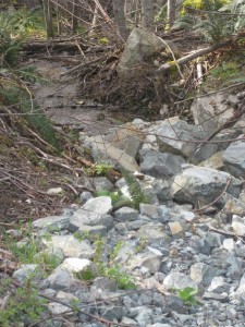
The quarry located on Lot 23 (shown in Figure 2 and pictured in the banner image above) is bordered to the west by CVRD parkland and to the north by Lot 21. Our journey took us from Stebbings Road along a parkland covenant on the south side of the quarry to the parkland immediately to the west. We hiked in parkland along the western edge of the quarry and made our first stop at the northwest corner of Lot23 where the photographs below were taken. At this location there exists a pond of water (top) that drains (bottom) eventually into Shawnigan Creek.
Figure 3: Photographs taken from the northwest corner of lot 23 where there exists a pond of water (top) that eventually drains (centre) into Shawnigan Creek.
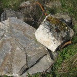
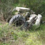
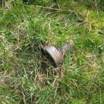
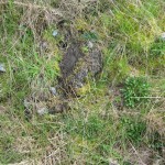
From this point we continued north along the western edge of Lot 21. Here it was readily evident that fill containing building materials was prevalent on the Lot 21 property. In fact, a significant amount of fill had over run Lot 21 and was on the neighbouring parkland. As we passed through the area I took a number of picture illustrating the type of building material that was present. A few examples are shown in Figure 4.
Figure 4: Photographs taken on CVRD land showing presence of building materials.
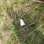
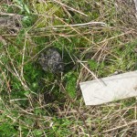
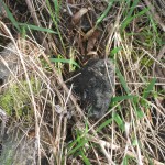
As evident in Figure 4, we discovered rebar, piping, concrete, asphalt, tiles, and even a tire. There seemed to be a large amount of fill in the form of building material on Lot 21.
Analysis of Water Samples
It is relatively straightforward to determine metal contents in runoff waters using an inductively coupled plasma mass spectrometry (ICPMS). Given the visible presence of steel products on the surface of the neighbouring CVRD parkland, I decided to collect water samples from two locations.
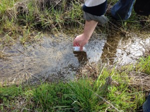
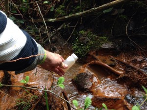
The first location (Site 1 in Figure 2 and denoted Plat in the analysis tables) was a relatively flat area that had standing water present at the surface. The second location (Site 2 in Figure 2 and donate Outflow in the analysis tables) was collected at the location where Lot 21 runoff entered Shawnigan Creek.
Figure 5: Photographs showing me collecting the water samples: Site 1 (left) and Site 2 (right).
The water flowing into Shawnigan Creek is orange (Figure 6) indicating an abundance of iron in solution.
Figure 6: Photographs of the water that runs from the north end of Site 21 into Shawnigan creek.
I passed the sample to my University of Victoria colleague Dr. Jay Cullen who in turn asked the UVic ICMPS Lab Manager, Dr. Jody Spence, if he would be able to analyse the samples. To process the samples the bottles were vigourously shaken, and the contents divided into two. One of the samples was filtered; one was not. Then 1 mL of environmental grade Nitric Acid was added to the unfiltered portion and left to sit overnight before analysis (this oxidizes and solubilizes more labile components of the precipitate that had formed). For the filtered portion, Dr. Spence used some sample to pre-rinse a clean syringe (all plastic, no rubber), and then filtered about 25 mL of sample through a 0.45 micron disposable filter. To this he added 0.5 mL of Nitric acid and let it sit overnight as well.
The results of the analysis are available in pdf format. All units in this table are in μg/L (micro gram per litre).
Schedule 6 of the Contaminated Sites Regulation of the Environmental Management Act lays out water standards for aquatic life, irrigation, livestock and drinking water. I will only concentrate on the drinking water standard although others may wish to compare my water results for aquatic life standards. As noted in Schedule 6 “Drinking water standards are for unfiltered samples obtained at the point of consumption.”
What is readily apparent from the analysed data is that the iron (Fe) levels fail drinking water standards locally. Manganese (Mn) levels are also high. These levels are almost certainly associated with the presence of buried steel (rebar, building materials etc.) on Lot 21. Nevertheless, by the time the water gets into Shawnigan Lake it will be so diluted that it would no longer fail these standards.
What is also important to note is that I have yet to analyse the water for hydrocarbon content. The presence of asphalt throughout the fill area would suggest that one might indeed expect to find hydrocarbons in the outflow.
Summary
What is apparent to me is that there are substantial amounts of building materials that have been placed on Lot 21. There is clear evidence that runoff from this site fails drinking water standards at the point of entry with Shawnigan Creek. And visually, this water looks nothing like any other water in nearby surface and running water. Missing from my analysis is an examination of hydrocarbon contents in the waters. I’ll save that for a later date.
There is conflicting evidence between the expert opinion provided as part of SIA’s application for a permit and that obtained by Shawnigan Resident’s Association. Herein lies the critical problem with the entire permitting process. The Professional Reliance model for project permitting in use in British Columbia is inherently flawed. No matter what project is seeking approval, when the government bases its decision on the professional advice provided by a project proponent, there will always be public concern. In fact basing approval decisions on the Professional Reliance Model makes it difficult, if not impossible, for a project to earn a social license to proceed.
The role of government is to protect the public interest while at the same time giving industry certainty with respect to the project approval process. My own view is that in order for both public and industry interests to be served transparently and fairly, British Columbia should move away from the Professional Reliance Model and instead create arms length and independent expert oversight panel(s). This can be accomplished by expanding in-house government technical expertise and using that expertise to set up independent oversight of a proponent’s project plan, paid for by the proponent. In addition, the Office of the British Columbia Ombudsperson report mentioned above and entitled The Challenges of Using a Professional Reliance in Environmental Protection – British Columbia’s Riparian Areas Regulation outlined a number of ways of improving the Professional Reliance model.
So how do we move forward from here? It makes little sense to me to dump contaminated soils in the Shawnigan Lake watershed. In addition, there are sufficient uncertainties in ground water processes/flow in the region that I don’t believe it is wise to place the contaminated soils at an elevation higher than nearby Sooke Lake (the source of Victoria’s drinking water). While overall risk may be small, it certainly is not zero and so it would be prudent to apply the precautionary principle in light of the stakes involved.
Instead, perhaps one of the three existing sites owned and operated by Tervita on Vancouver Island could take the contaminated soils. One is in the Highlands, one is in Cumberland and one is near Port McNeill. Tervita has a long history of successfully operating contaminated soil sites. If additional capacity is needed, then let’s start the process over again and search for a different location. But this time either follow the advice of the Ombudsperson’s office or establish and independent panel to oversee the permitting process.
Postscript
I discussed this issue further on CBC radio with Gregor Craigie on Earth Day (April 22, 2015).
Vancouver’s Transit Referendum — A synopsis
In the coming weeks, hundreds of thousands of ballots will be mailed out across Metro Vancouver asking residents a simple question:
“Do you support a new 0.5% Metro Vancouver Congestion Improvement Tax, to be dedicated to the Mayors’ Transportation and Transit Plan? Yes or No.“
If I lived in Vancouver, I would vote ‘Yes’. I would do so reluctantly. I would do so begrudgingly. And I would do so frustratedly, knowing that my provincial government had abdicated its leadership responsibility. Yet I would hope with all sincerity for a ‘Yes’ victory.
Vancouver is Canada’s most congested city and the third most congested city in North America, behind Los Angeles and Mexico City. As noted in a recent story by Ian Bailey in the Globe and Mail , “the average Vancouver driver experiences 87 hours of delay time a year based on a 30-minute daily commute.” With a population of more than 2.5 million and growing, it is without doubt that Metro Vancouver needs to make substantial investments in improving its public transportation.
The Problem with the Referendum
But let’s be very clear. This referendum is a waste of taxpayers’ money and demonstrates an appalling lack of leadership by the Liberal Government. The province is abdicating its responsibility to govern and the level of inconsistency being displayed is truly mind boggling. This same government has no problem announcing high-profile ribbon-cutting opportunities like replacing the Massey Tunnel with a bridge or adding a second bridge across Okanagan Lake without even a hint of a referendum. So why are we having one now?
That this government would hamstring Metro Vancouver Mayors with a referendum on new funding for transit infrastructure—a policy that both the government and the official opposition support—is unconscionable.
In my opinion we are left with two fundamental and unanswered questions:
- Why are we having a referendum on a policy when both the Government and Official Opposition, as well as business groups and other stakeholders, all agree that new funding is required to address congestion in the Lower Mainland?
- If we go through with a referendum and it gets voted down, what is the Plan B for the BC Liberals to address the transportation issues facing our largest population centres?
In the Spring of 2014, when the government introduced Bill 23 — South Coast British Columbia Transportation Authority Funding Referenda Act, the BC NDP spoke passionately against the bill. They argued, like I do above, that the government should show leadership and empower the Mayors Council to move forward with their transportation plans. They also pointed out that there were no details about any back up plan in case the referendum failed.
More recently the Premier has suggested that the Mayor’s could use Property Tax hikes to fund transit improvements if the referendum failed. In my opinion, this is the greatest abdication of responsibility we have seen so far. To reject Mayors’ initial strategy to raise funds, to then force a referendum on them that the Mayors didn’t want, and then to suggest that it is the Mayors’ responsibility to find the funding if the referendum fails, is indicative of a provincial government that is lacking leadership and doing all it can to avoid taking responsibility.
An Alternative Approach
So what do I think we should be doing?
During the election I campaigned on increasing the carbon levy by $5 per year until it hits $50/tonne, at which point we could assess where we are at. Currently, the carbon levy is revenue neutral; all of the revenue collected is subsequently returned to the economy through personal income tax and small business tax credits. But it doesn’t have to be that way going forward. For example, Quebec used their carbon levy revenue to improve public infrastructure.
During the election campaign I argued that Municipalities across British Columbia are facing an infrastructure deficit. Our public infrastructure (roads, sewers, bridges etc) was built last century. It is now old and crumbling and increasingly strained as our population grows.
Property tax increases are becoming unbearable for many, particularly seniors on fixed-income. Deferring property tax payments into the future doesn’t deal with the problem today. So I argued that during the next phase of the carbon levy increase (the next four years) all monies could be returned to municipalities to support them to deal with their infrastructure deficits, including public transportation.
By steadily increasing emissions pricing, we send a signal to the market that incentivises innovation and the transition to a low carbon economy. The funding transferred to municipalities across the province provides them with resources to deal with their aging infrastructure and growing transportation issues. By investing in the replacement of aging infrastructure in communities throughout the province we stimulate local economies and create jobs.
And importantly, by moving to this polluter-pays model of revenue generation for municipalities, we reduce the burden on regressive property taxes. Done right, this model could lead to municipalities actually reducing property taxes, thereby benefitting homeowners, fixed-income seniors, landlords and their tenants.
What better time to do this than now, with the price of oil hovering at $50/barrel. Most businesses would have already budgeted for a much higher price for oil. And the beauty of this approach is that as revenues from emissions pricing go down, direct revenues from public transport go up as more people move from single passenger vehicles to the skytrain.
While I recognize it may be too late to cancel the referendum, it’s time that we start having a more open and honest discussion about our aging infrastructure, the requirements for public transport and the means of generating revenue to pay for them.
Response of Greater Victoria councils welcomed
Media Statement: October 8, 2014
Response of Greater Victoria councils to calls for governance questions on the November ballots welcomed
For Immediate Release
Victoria B.C. – Andrew Weaver, MLA for Oak Bay – Gordon Head and Deputy Leader of the B.C. Green Party, welcomes the response of local councils to calls for governance questions to be on the November 15th local elections ballots in Greater Victoria. Saanich, Oak Bay and six more of the thirteen municipalities within the Capital Regional District will place a non-binding question seeking public input on shared services, local and regional governance and, in some cases, the potential for amalgamation. A positive vote will trigger a study on local governance and publically-funded services, leading to recommendations on the future of local and regional governance.
“This is welcome news. It is encouraging to see democracy at work with local mayors and councillors listening to their communities,” said Andrew Weaver. “I am hopeful that this kind of public engagement will serve as a catalyst to increase voter turnout in the November municipal elections”.
Today, the Honourable Coralee Oakes, Minister responsible for local government, congratulated the municipalities that have placed a governance question on the November 15th ballot, and stated her office and staff are available to assist with resources and support.
“The Minister’s announcement that resources and staff are available to support a governance study, is appreciated and demonstrates that they too are listening to residents of the capital regional district,” said Andrew Weaver. “It is vital the province and local governments work together to ensure residents are fully consulted and have an opportunity to voice their questions and ideas as this moves forward.”
-30-
Media Contact
Mat Wright – Press Secretary, Andrew Weaver MLA
mat.wright@leg.bc.ca
1 250 216 3382
Poll shows Greater Victoria residents keen on governance study
Media Statement: July 29, 2014
Poll Shows Greater Victoria Residents Keen on Governance Study
For Immediate Release
Victoria B.C. – An Angus Reid survey, commissioned by Amalgamation Yes, clearly shows the vast majority of residents, in all 13 Greater Victoria municipalities, are concerned about local and regional governance and support exploring options.
The key findings are:
89% of respondents support a non-binding referendum on amalgamation.
84% of respondents are in favour of some sort of amalgamation.
80% of respondents support an independent, comprehensive cost-benefit study and analysis of amalgamation.
While a majority of respondents are satisfied with the services they receive from local government, there are concerns around the efficiency of service delivery across the Capital Region, as well as with planning, decision making and cooperation between municipalities.
There is an opportunity to place a non-binding question on the ballot for the November municipal elections which would directly inform councils and the CRD about existing support for a regional governance study. The Province can fund a study should a group of municipalities, or the region as a whole, seek assistance.
“This is an important survey. People in Greater Victoria are clearly engaged and interested in how their communities are governed and want a say on future directions. I encourage Mayors and councils in each municipality to put a question on November’s ballot on studying options for improving local and regional governance,” says Andrew Weaver.
For the full Angus Reid survey results, analysis and background material please see www.amalgamationyes.ca
Media Contact
Mat Wright – Press Secretary, Andrew Weaver MLA
mat.wright@leg.bc.ca
1 250 216 3382

